Louis Albert Guislain Bacler d’Albe
Command Ratings
Louis Albert Guislain Bacler d’Albe (also encountered in period and later catalogues as “Louis‑Albert‑Ghislain” and as “baron Bacler d’Albe”) was a French artillery officer who became one of the principal specialist staff officers of Napoleon Bonaparte’s headquarters through his long direction of the Emperor’s cartographic and topographic services. Trained first as an artist and draftsman, he entered military service during the Revolutionary Wars and rose—through a career conducted largely in staff and technical appointments rather than line command—to the rank of général de brigade in 1813. Across the Major continental campaigns of the Consulate and Empire, his work lay in collecting, systematizing, and presenting topographical intelligence, in maintaining a working cartographic archive for operational planning, and in providing Napoleon with continuously updated maps and route data at the imperial headquarters. His administrative service also extended to stewardship of the Dépôt de la Guerre, the central state institution responsible for military mapping and geographic engineering, including its copper plates and archives.
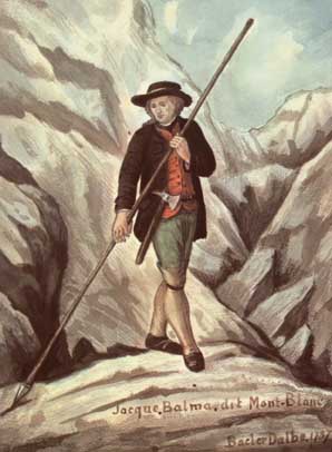
Born on 21 October 1761 at Saint‑Pol‑sur‑Ternoise in Artois, Bacler d’Albe came to adulthood during the late Ancien Régime and initially pursued a civilian career connected with drawing, engraving, and landscape art. By the mid‑1780s he had established himself in the alpine region around Mont‑Blanc, producing views and topographical drawings that reflected both artistic ambition and an emerging technical interest in terrain representation. These years created the distinctive blend of draughtsmanship and geographic method that later made him useful to the armies of the Republic. His transition to military life occurred after the outbreak of the Revolutionary Wars, when the rapid expansion of French forces created demand for officers able to reconnoiter, sketch, and compile usable terrain information for commanders operating beyond established survey coverage.
He enlisted as a volunteer in May 1793 (in the 2nd Battalion of chasseurs of Ariège, according to several biographical compilations). During 1793 he was present in Major internal and external crisis theaters, notably at the sieges of Lyon and Toulon. At Toulon he encountered Bonaparte, then a rising artillery officer. Bacler d’Albe’s early wartime function combined artillery service with topographic and artistic tasks: he was employed to depict terrain and works, and to translate reconnaissance into sketches and plans suitable for batteries and siege operations. This pattern—technical staff labor carried out under operational pressure—was to define his wartime career.
From 1794 Bacler d’Albe was attached to the Army of Italy and associated services that required geographic officers capable of reconnaissance, mapping, and compilation. In this theater, where campaigning was conducted across complex alpine and Apennine terrain and where existing maps varied widely in quality, the value of rapid and coherent cartographic products was high. Bacler d’Albe became identified with the cartographic requirements of the Army of Italy and was drawn into Bonaparte’s circle as Bonaparte assumed command in 1796. In the First Italian Campaign (1796–1797), Bacler d’Albe accompanied the headquarters and worked on assembling and producing usable maps for route selection, river crossings, and the positioning of forces in constricted valleys and on broken ground. He was present during the campaign that included the fighting around Arcole in November 1796, and he later produced large battle paintings that, while artistic in intent, reflected an eyewitness’s attention to ground forms, waterways, and road nets.
Following the initial Italian victories and the political reordering of northern Italy, Bacler d’Albe’s technical employment extended into the mapping needs of the new client states, where French armies required not only campaign sketches but also more systematic topographic products. He was associated with the organization of cartographic work in Milan and with the compilation of Italian mapping between roughly 1797 and 1799. This phase of his service linked him to the broader institutional framework of French military geography: engineering-geographer personnel, survey compilation, engraving, and the storage of plates and manuscript materials.
In 1799 he returned to close personal service under Bonaparte as the latter seized power and reorganized the state and the armed forces. Bacler d’Albe’s employment now shifted from being merely a talented geographic officer attached to an army to being a central figure in an emerging headquarters apparatus that fused intelligence, mapping, and planning support. In Paris he was connected to the Dépôt de la Guerre and participated in efforts toward standardization and consolidation in French military cartography. His work involved collecting disparate regional surveys, reconciling scales and symbols, and preparing finished products for staff use. At the same time, he continued to develop techniques of relief depiction—especially shaded relief—that improved the rapid comprehension of terrain on working maps.
A decisive appointment came in September 1804, when he became chief of the Emperor’s topographical bureau—the personal cartographic office serving Napoleon’s cabinet and field headquarters. From this point until March 1814, Bacler d’Albe followed Napoleon on campaign and remained closely tied to the imperial staff system. His office, positioned physically near Napoleon’s working space and on campaign near the imperial tent, was charged with laying out the best available map coverage for the theater of operations, annotating it with current dispositions as information arrived, and keeping a coherent set of reference materials that included route distances, river lines, defiles, and the location of key crossings, magazines, and fortified points. In practice, this demanded constant management of incoming reports, reconnaissance notes, and captured or purchased foreign maps, as well as the daily maintenance of a large map-table on which operational planning and revisions were conducted.
Bacler d’Albe’s role at headquarters also included the preparation of march data—distances, timings, and route alternatives—derived from maps, road-books, and staff reconnaissance. While the formal transmission of orders and the drafting of operational instructions rested with Napoleon’s chief of staff and the major général’s apparatus, Bacler d’Albe’s contribution lay in furnishing the geographic frame within which those orders were conceived. In the campaigns of the Empire he was therefore present not as a commander of a line formation but as a senior technical officer whose output underpinned decisions on axis of advance, concentration points, river passages, and the exploitation of terrain for maneuver.
His rank progression during the Empire reflected the technical character of his appointments. He became chef d’escadron in 1801. After years of intensive headquarters service, he was promoted to colonel on 21 June 1807 and shortly afterward to adjudant-commandant (a senior staff rank commonly associated with headquarters duties). In 1808 he received the imperial nobility as chevalier of the Empire, and by decree of 31 December 1809 (often reported in biographies as early 1810 by effective date) he was created baron of the Empire. These distinctions corresponded to his perceived indispensability in the imperial working method, but they also underscore that his career path was not that of a field general commanding divisions or corps; it was that of a specialist integrated into the Emperor’s immediate decision apparatus.
During the great campaigns of 1805–1807—Ulm-Austerlitz, Jena-Auerstädt, and the operations culminating at Friedland—Bacler d’Albe’s bureau was responsible for assembling and revising map coverage of central Europe, including regions where French archives had limited prewar detail. The headquarters had to integrate Austrian, Prussian, Polish, and other cartographic materials, along with reconnaissance updates, in order to maintain a usable operational picture. Bacler d’Albe’s work in these years also contributed to the longer-term project commonly associated with him: the preparation of a homogeneous map set covering much of Europe, an ambitious compilation intended to provide Napoleon with standardized cartographic coverage rather than a patchwork of inconsistent sheets. The compilation and maintenance of this body of maps required both administrative continuity in Paris and the practical capacity to carry and use working map sets on campaign.
In the Peninsular War period, Bacler d’Albe accompanied Napoleon during the 1808 intervention in Spain. The Iberian theater posed acute mapping challenges because of the breadth of the theater, varied road conditions, and the need to coordinate movements across multiple axes while operating amid hostile populations and dispersed enemy forces. The topographical bureau’s task here involved working from incomplete or heterogeneous Spanish mapping and from French reconnaissance to maintain the Emperor’s planning materials. In 1809 he was again with Napoleon in the Danube theater against Austria, where the operational environment combined river barriers with complex approaches to Vienna and the Marchfeld; the headquarters’ dependence on precise mapping, particularly for river lines and crossings, remained central.
The Russian campaign of 1812 exposed the most extreme logistical and cartographic demands placed on Napoleon’s headquarters. The topographical bureau had to manage extended lines of march across regions where French mapping was sparse and where reliance on foreign maps, intelligence from allied contingents, and hurried reconnaissance was unavoidable. Bacler d’Albe is repeatedly associated in biographies with the loss of parts of the Emperor’s compiled European map set during the retreat from Russia, a loss that indicates both the physical vulnerability of headquarters materials in catastrophe and the scale of what had been assembled. In 1813, after the reconstruction of the field army and the resumption of Major campaigning in Germany, Bacler d’Albe remained at Napoleon’s side. He was appointed an officier de la Légion d’honneur on 10 April 1813 and was promoted to général de brigade on 24 October 1813. By this stage, his seniority within the headquarters staff and his long responsibility for the imperial topographical bureau had made him one of the best-known technical officers of the imperial entourage.
In the crisis of 1814, Bacler d’Albe’s appointment shifted back toward institutional leadership. On 2 March 1814 he became director of the Dépôt de la Guerre in Paris, taking responsibility for the central archives and production mechanisms of French military cartography at a moment when Allied armies threatened the capital and when the custody of plates and manuscripts carried both strategic and state value. He remained in this post during the transition to the Bourbon Restoration, being confirmed by Louis XVIII on 10 May 1814. During the Hundred Days of 1815 he again held a senior administrative post (chef de division in the ministry), and he is associated with the safeguarding of the engraved copper plates of the Cassini map of France—an irreplaceable national cartographic asset—against Allied seizure or dispersal. His active military career is generally dated as ending in 1815.
After 1815 Bacler d’Albe lived under political suspicion typical of prominent imperial servants and increasingly returned to artistic production, publishing and creating lithographs based on sketches made during campaigns and travels. Nonetheless, his career cannot be separated from the technical-military sphere: his art was often grounded in terrain observation, and his methods of relief depiction and landscape representation were closely aligned with the needs of military geography. He died at Sèvres on 12 September 1824.
Within Napoleonic military administration, Bacler d’Albe’s significance lay in the continuity of his service at the highest level of headquarters and in his stewardship of the tools by which terrain knowledge was converted into actionable plans. His work joined three domains—field reconnaissance depiction, archive-level cartographic compilation, and the daily map-table practice of imperial headquarters—into a single career that culminated in general officer rank without the customary sequence of field commands.
Sources
- Napoleon.org: BACLER D’ALBE, Louis Albert Guislain, baron (1761-1824), ingénieur-géographe, dessinateur
- Napoleon Series: Generals Who Served in the French Army during the Period 1789–1814 (entry: Bacler d’Albe)
- British Museum Collection: Louis Bacler d’Albe (BIOG18074)
- National Gallery of Art: Baron Louis-Albert-Guillain Bacler d'Albe (artist page)
- Wikipedia (English): Louis Albert Guislain Bacler d'Albe
- Wikipedia (French): Louis Albert Guislain Bacler d'Albe
- History of War: General Louis-Albert-Ghislain, baron Bacler d'Albe, 1761-1824


XX - Chief of Napoleon's topographic bureau. X rank in 1813. (1761-1824). A painter by profession.